
Asia is a huge place! It covers an estimated 30% of the world's land area; roughly it is about 44,391,000 square kilometers. It's conventional geographical boundaries are:
On the north: the Arctic Ocean
On the east: the Bering Strait and the Pacific Ocean
On the southwest: the Red Sea and the Mediterranean Sea
On the west is: the Ural Mountains going south tracing the Ural River until you get to the Caspian Sea and then going west along the Caucasus Mountains until you get to the Black Sea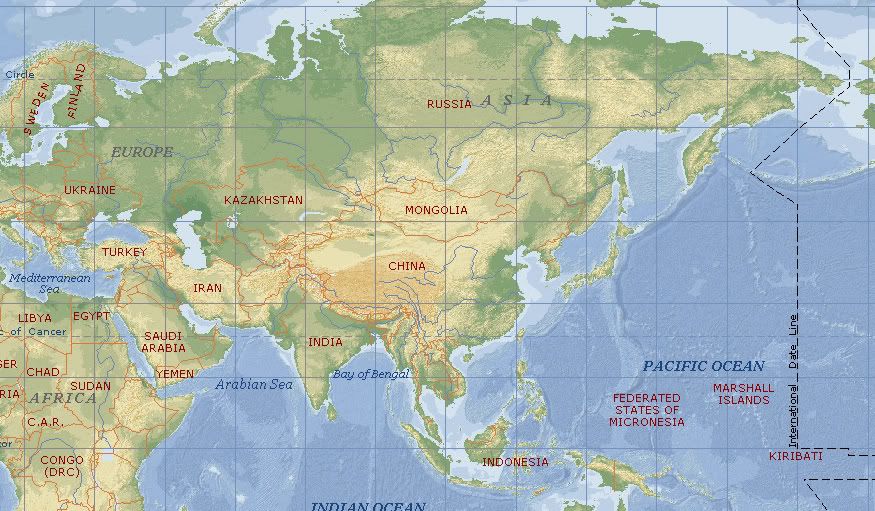 But that's only half of the story.
There are plenty of countries that belong to the Asian continent, which is why it is also divided into several realms: East Asia, South Asia, Southwest Asia, Southeast Asia, "Russian"/Central Asia. Which countries are in the Asian continent? To which realm/sub-division does each country belong?
Our study of major asian civilizations will include only the following areas: East Asia (civilization in China, Japan, Korea), South Asia (civilization in India and those that it influenced and those that emerged in south asia), and Southeast Asia
Why? Well, that's one of the tasks i gave you this week. I expect that next meeting you will have an idea of why i chose only those four. Here are a few images to give you clues on how to approach the task.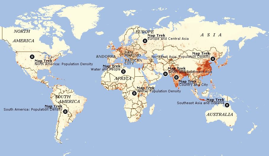 This is a population density map of the world. The more red you see, the higher the population density.
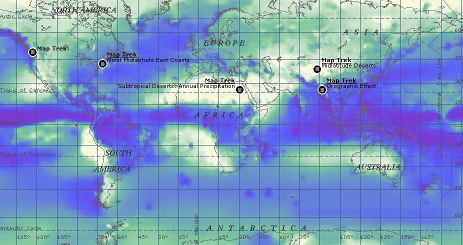
This is a rainfall map of the world. Again, the deeper the blue, the more rainfall that place gets in a year.
These images should set your minds twirling. What's so distinct about the parts of the Asian continent that we are going to study in relation to these images?
Wednesday, June 27, 2007
Where in the world is Asia?
Subscribe to:
Post Comments (Atom)

8 comments:
sir,,is the population and the climate has something to do with ur choice??hehhehhhe..
wow!! what a new info..!!!
now I know what place has more rainfall and more population...!!!
next!!!..;)
sir... r we supos to post d tasks bout asia? hehehe.. (memory gap) toinx.! im not yet fnished reading d hul chapetr but i know some things na rin.. hehe.. i can relate wat uv been writng dr.. charos.! d pictures r not clear pla sir.. prang mas clear pa sa buk..
nwei... sir.. i can't understand masxado ung sa rainful asia.. bout d water cycle thing.. ung moisture moisture echus..hehe.. basta bout d monsoon asia thing.. but i know na y only china, japan korea, india and southeast asia lng ung pag-uusapan natin..
sir, i might say that u choose d 4 areas because these are d areas that had a high population e.g., India and China and has the great amount of rainfall or rainy season in a year..;-)
about the maps ... they appear blurred when you look at them in the post. But you can click each map to see a much more detailed and clearer view. then just click the "back" button on your browser to get back to the original post.
hope that helps
i guess ur idea of choosing those country has something to do with the population and the climate .... hehe...and i think much is there to say if a country has more population...much has been built and much culture has been exercised.... hehe...lalang...charos...
y18it is simply becoz these 4 areas really rocks! these areas contributed and still contributing to ASIAN CIVILIZATION! they are what we call "LEGENDS"!
I think the reason why only 4 countries you chose it is because of the quantity of population and the economy of that place..
especially that those you chose are very highly known and technological countries. their economy are stable and developed...
also on these four they have the largest number of population than any others...
that's what i think.. ;)
Post a Comment