
Finally, i got around to taking photos of the maps that you made. Everyone did a great job. Your maps are more than what i expected given the limitations particular to each section.
Here's a short media presentation of our past activities. Enjoy!
N4C deserves special mention for abiding with our agreement the week prior to our map making activity. They finished the map at least on the same day of the map making activity. Because N4A and N4B begged off on our agreement, i think it would be fair that the prize, whatever it may be (wink, wink!), should go to N4C.
Nevertheless, everyone gets high merit for excellent work not only on your maps but in our "Show and Tell Asia!" activity too.
Keep up the good work!
Read more!
Showing posts with label asia geography. Show all posts
Showing posts with label asia geography. Show all posts
Wednesday, July 11, 2007
Great Work Everyone!
Wednesday, June 27, 2007
Where in the world is Asia?
Asia is a huge place! It covers an estimated 30% of the world's land area; roughly it is about 44,391,000 square kilometers. It's conventional geographical boundaries are:
On the north: the Arctic Ocean
On the east: the Bering Strait and the Pacific Ocean
On the southwest: the Red Sea and the Mediterranean Sea
On the west is: the Ural Mountains going south tracing the Ural River until you get to the Caspian Sea and then going west along the Caucasus Mountains until you get to the Black Sea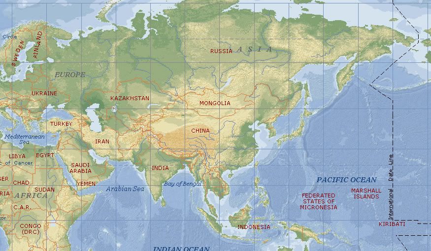 But that's only half of the story.
There are plenty of countries that belong to the Asian continent, which is why it is also divided into several realms: East Asia, South Asia, Southwest Asia, Southeast Asia, "Russian"/Central Asia. Which countries are in the Asian continent? To which realm/sub-division does each country belong?
Our study of major asian civilizations will include only the following areas: East Asia (civilization in China, Japan, Korea), South Asia (civilization in India and those that it influenced and those that emerged in south asia), and Southeast Asia
Why? Well, that's one of the tasks i gave you this week. I expect that next meeting you will have an idea of why i chose only those four. Here are a few images to give you clues on how to approach the task.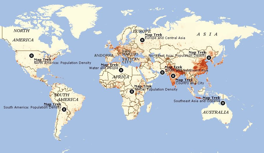 This is a population density map of the world. The more red you see, the higher the population density.
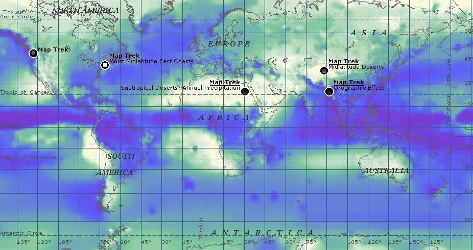
This is a rainfall map of the world. Again, the deeper the blue, the more rainfall that place gets in a year.
These images should set your minds twirling. What's so distinct about the parts of the Asian continent that we are going to study in relation to these images?
Read more!
Subscribe to:
Posts (Atom)
